


Pix4Dcapture

คำอธิบายของPix4Dcapture
Pix4Dcapture turns your consumer drone into a professional drone mapping tool. A free companion to Pix4D photogrammetry software, Pix4Dcapture is the perfect tool to automatically capture image data - RGB, thermal - for optimal 3D models and maps. Process post-flight images easily on the cloud or desktop applications, producing georeferenced maps and models that are tailored to many industry needs.
Currently, the app supports and was tested for the following drones:
• DJI
- Phantom 4 Pro v2.0
- Phantom 4 Pro
- Phantom 4
- Mavic 2 Pro
- Mavic Pro
- Mavic Air
- Matrice 200
- Matrice 210
- Matrice 210 RTK
- Inspire 2
- Inspire 1 (Pro)
- Phantom 3 Professional
- Phantom 3 Advanced
- Phantom 3 Standard
- Matrice 100
- Spark
• Parrot
- Anafi with Skycontroller 3
- Anafi Thermal with Skycontroller 3 (RGB + Thermal Images)
- Bluegrass with Skycontroller 2
- Bebop 2 with Skycontroller 2
• Yuneec
- H520 with E90 camera and ST16S controller (compatible version available from support page)
Features and benefits:
- Fully automated drone mapping
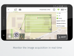
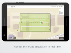
- Drone telemetry and camera live feed during the image acquisition
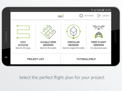
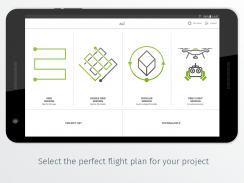
- Different flight plans for different needs
- Polygon Mission for general mapping
- Grid Mission for general mapping
- Double Grid Mission for better 3D model reconstruction
- Circular Mission for point-of-interest 3D model reconstruction
- Free Flight Mission for vertical object mapping with manual flight control
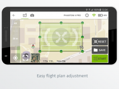
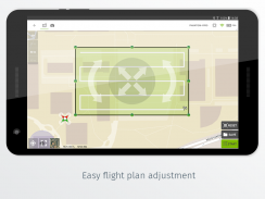
- Flight parameters for each mission - front & side image overlap, camera angle, altitude,
flight speed - can be adjusted based on the requirements of the area.
- Save or duplicate missions to fly the same area of interest several times
- Combine several missions into one project in the project manager
- Precise mission planning by importing KML/KMZ files
- Store the basemap with your flight plan using offline maps
- Change street/satellite basemap provider
- Seamless workflow with Pix4D’s processing software
- Automated image transfer from drone-to-device
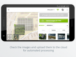
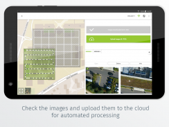
- Upload images directly from the device to Pix4D software in the cloud for processing (license required)
Post-flight processing & analysis using Pix4D’s software on cloud or desktop:
- Achieve survey-grade results from lightweight and compact cameras to large-frame metric cameras
- Usage of Ground Control Points (GCPs) for improving the relative and absolute accuracy of the model
- Generate and modify
- Point clouds
- Orthomosaics
- Digital elevation models (DSM/DTM)
- Index maps (e.g. NDVI)
- And more
- Measure distances, surfaces, and volumes
Important information:
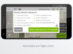
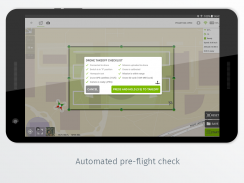
Ensure you have the latest firmware installed on your drone and the app is up to date. The app follows the flight plan and does not avoid obstacles automatically. Pix4D accepts no liability for damage, injuries or legalities from the misuse of this app. Use only in safe environments.
Pix4Dcapture เปลี่ยนเสียงหึ่งๆของผู้บริโภคให้กลายเป็นเครื่องมือทำแผนที่เสียงพึมพำมืออาชีพ ฟรีซอฟแวร์ Photogrammetry Pix4D สหายฟรีสำหรับ Pix4Dcapture เป็นเครื่องมือที่สมบูรณ์แบบในการจับภาพข้อมูลโดยอัตโนมัติ - RGB, ความร้อน - สำหรับโมเดล 3D และแผนที่ที่ดีที่สุด ประมวลผลภาพหลังการบินได้อย่างง่ายดายบนแอปพลิเคชั่นบนคลาวด์หรือเดสก์ท็อปสร้างแผนที่และแบบจำลองทางภูมิศาสตร์ที่เหมาะกับความต้องการของอุตสาหกรรม
ปัจจุบันแอพรองรับและผ่านการทดสอบสำหรับโดรนต่อไปนี้:
• DJI
& nbsp; - Phantom 4 Pro v2.0
& nbsp; - Phantom 4 Pro
& nbsp; - Phantom 4
& nbsp; - Mavic 2 Pro
& nbsp; - Mavic Pro
& nbsp; - Mavic Air
& nbsp; - ราคา 200
& nbsp; - Matrice 210
& nbsp; - Matrice 210 RTK
& nbsp; - สร้างแรงบันดาลใจ 2
& nbsp; - สร้างแรงบันดาลใจ 1 (Pro)
& nbsp; - Phantom 3 Professional
& nbsp; - Phantom 3 ขั้นสูง
& nbsp; - มาตรฐาน Phantom 3
& nbsp; - ครบกำหนด 100
& nbsp; - จุดประกาย
•นกแก้ว
& nbsp; - Anafi กับ Skycontroller 3
& nbsp; - Anafi Thermal พร้อม Skycontroller 3 (RGB + ภาพความร้อน)
& nbsp; - Bluegrass พร้อม Skycontroller 2
& nbsp; - Bebop 2 กับ Skycontroller 2
• Yuneec
& nbsp; - H520 พร้อมกล้อง E90 และคอนโทรลเลอร์ ST16S (มีรุ่นที่รองรับจากหน้าสนับสนุน)
คุณสมบัติและประโยชน์:
& nbsp; - การจับคู่จมูกอัตโนมัติเต็มรูปแบบ
& nbsp; - ระบบตรวจสอบระยะไกลและกล้องถ่ายทอดสดกล้อง ในระหว่างการรับภาพ
& nbsp; - แผนการบินที่แตกต่างกันสำหรับความต้องการที่แตกต่างกัน
& nbsp; & nbsp; - ภารกิจรูปหลายเหลี่ยม สำหรับการทำแผนที่ทั่วไป
& nbsp; & nbsp; - ภารกิจกริด สำหรับการทำแผนที่ทั่วไป
& nbsp; & nbsp; - ภารกิจกริดคู่ เพื่อการสร้างโมเดล 3 มิติที่ดีขึ้น
& nbsp; & nbsp; - ภารกิจเวียน สำหรับการสร้างโมเดล 3 มิติที่น่าสนใจ
& nbsp; & nbsp; - ภารกิจเที่ยวบินฟรี สำหรับการจับคู่วัตถุในแนวตั้งพร้อมการควบคุมการบินด้วยตนเอง
& nbsp; - พารามิเตอร์การบินสำหรับแต่ละภารกิจ - ด้านหน้า & amp; ด้าน ภาพซ้อนทับ , มุมกล้อง , ระดับความสูง
& nbsp; & nbsp; & nbsp; & nbsp; & nbsp; ความเร็วเที่ยวบิน - สามารถปรับได้ตามความต้องการของพื้นที่
& nbsp; & nbsp; & nbsp; - บันทึก หรือ ภารกิจซ้ำซ้อน เพื่อบินพื้นที่ที่น่าสนใจหลาย ๆ ครั้ง
& nbsp; & nbsp; & nbsp; - รวมหลายภารกิจไว้ในโครงการเดียวใน ผู้จัดการโครงการ
& nbsp; & nbsp; & nbsp; - การวางแผนภารกิจที่แม่นยำโดย นำเข้าไฟล์ KML / KMZ
& nbsp; & nbsp; & nbsp; - จัดเก็บแผนที่ฐานด้วยแผนเที่ยวบินของคุณโดยใช้ แผนที่ออฟไลน์
& nbsp; & nbsp; & nbsp; - เปลี่ยน ผู้ให้บริการแผนที่ / ดาวเทียม basemap
& nbsp; & nbsp; & nbsp; - ขั้นตอนการทำงานที่ราบรื่นด้วยซอฟต์แวร์ประมวลผลของ Pix4D
& nbsp; & nbsp; & nbsp; & nbsp; - การถ่ายโอนภาพอัตโนมัติจาก drone-to-device
& nbsp; & nbsp; & nbsp; & nbsp; - อัปโหลดภาพ โดยตรงจากอุปกรณ์ไปยังซอฟต์แวร์ Pix4D ในคลาวด์เพื่อการประมวลผล (ต้องมีใบอนุญาต)
การแปรรูปภายหลังเที่ยวบิน & amp; วิเคราะห์โดยใช้ซอฟต์แวร์ของ Pix4D บนคลาวด์หรือเดสก์ท็อป:
& nbsp; - รับผลการสำรวจระดับคุณภาพจากกล้องที่มีน้ำหนักเบาและกะทัดรัดไปจนถึงกล้องเมตริกขนาดใหญ่
& nbsp; - การใช้ จุดควบคุมภาคพื้น (GCPs) เพื่อปรับปรุงความแม่นยำและความแม่นยำของโมเดล
& nbsp; - สร้างและแก้ไข
& nbsp; & nbsp; - Point clouds
& nbsp; & nbsp; - Orthomosaics
& nbsp; & nbsp; - รุ่นการยกระดับแบบดิจิตอล (DSM / DTM)
& nbsp; & nbsp; - ดัชนีแผนที่ (เช่น NDVI)
& nbsp; & nbsp; - และอีกมากมาย
& nbsp; - วัด ระยะทาง , พื้นผิว และ ปริมาณ
ข้อมูลสำคัญ:
ให้แน่ใจว่าคุณติดตั้งเฟิร์มแวร์ล่าสุดบนโดรนของคุณและแอพนั้นทันสมัย แอพจะติดตามแผนการบินและจะไม่หลีกเลี่ยงอุปสรรคโดยอัตโนมัติ Pix4D ไม่รับผิดชอบต่อความเสียหายการบาดเจ็บหรือข้อกฎหมายจากการใช้งานแอพนี้ในทางที่ผิด ใช้ในสภาพแวดล้อมที่ปลอดภัยเท่านั้น


